Neutral, Structured Scene Documentation for Fire and Property Losses
ROAR Documentation™ is a specialized documentation service provided by ROAR Drones LLC, designed to preserve fire and property loss scenes with clarity, accuracy, and professional restraint.
This service exists to capture observable conditions early, before scenes change due to overhaul, cleanup, weather, demolition, or repair. The goal is not to interpret or analyze a loss, but to create a clear, organized record that allows stakeholders to review the scene as it existed at the time of documentation.
ROAR Documentation™ supports adjusters, investigators, engineers, attorneys, and risk managers who need reliable reference material long after physical access to a scene is limited or no longer possible.
What This Service Provides
ROAR Documentation™ focuses on systematic, non-interpretive documentation, captured with context and orientation in mind.
Depending on scope and site conditions, documentation may include:
High-resolution still imagery
Room-by-room interior documentation
Exterior and site context imagery
Spatially accurate visual references
Organized, timestamped deliverables suitable for later review
Documentation is captured using a consistent methodology so reviewers can understand where damage exists, how it relates to surrounding conditions, and how spaces connect within the structure.
Deliverables are structured for efficient use by multiple parties and are suitable for claims review, consultation, and legal reference.
Fire Scene Documentation Approach
When documenting fire-damaged scenes, ROAR Documentation™ follows documentation practices consistent with the principles outlined in NFPA 921, while remaining strictly within a documentation-only role.
This means:
Conditions are recorded as found and observed
No investigative analysis is performed
No origin-and-cause determinations are made
No opinions or conclusions are offered
The service is designed to support investigative and claims workflows, not replace them.
What ROAR Documentation™ Does Not Do
To maintain neutrality and defensibility, ROAR Documentation™ does not:
Determine cause or origin of a fire
Interpret burn patterns or damage mechanisms
Move, collect, or process physical evidence
Perform investigative analysis
Provide expert opinions or conclusions
ROAR Documentation™ documents conditions, not significance.
Ideal Use Cases
This service is commonly used for:
Fire-damaged residential and commercial structures
Smoke and water loss documentation
Large or complex property losses
Multi-unit or multi-party claims
Time-sensitive scenes prior to cleanup, remediation, or demolition
Losses requiring review by multiple stakeholders over time
ROAR Documentation™ is particularly valuable when access to a scene will be limited later or when documentation quality is critical to downstream decision-making.
Why ROAR Documentation™
Neutral, unbiased presentation
Documentation is delivered without interpretation or advocacy.
Scene-first perspective
Images are captured with spatial context and orientation, not as isolated snapshots.
Structured deliverables
Files are organized so reviewers can quickly locate relevant areas and understand relationships within the scene.
Scalable capability
Services scale from single-family residences to large commercial and multi-unit properties.
Field-informed workflows
Documentation practices are informed by real-world fire, loss, and emergency response environments.
Who Uses ROAR Documentation™
Independent insurance adjusters
Insurance carriers and SIU teams
Private fire investigation firms
Engineers and technical consultants
Attorneys and legal teams
Property owners and risk managers
Service Availability
ROAR Documentation™ services are typically deployed early in the loss timeline to preserve conditions before changes occur. Regional and surge-response availability may be offered depending on event scope.
About the Name
ROAR Documentation™ is a documentation division of ROAR Drones LLC.
The term “Documentation” reflects a deliberate commitment to accuracy, neutrality, and professional restraint.
Pricing
ROAR Documentation™ engagements typically start at $400 and scale based on scene size, complexity, access, and documentation scope. Custom quotes are available for larger or time-sensitive losses.


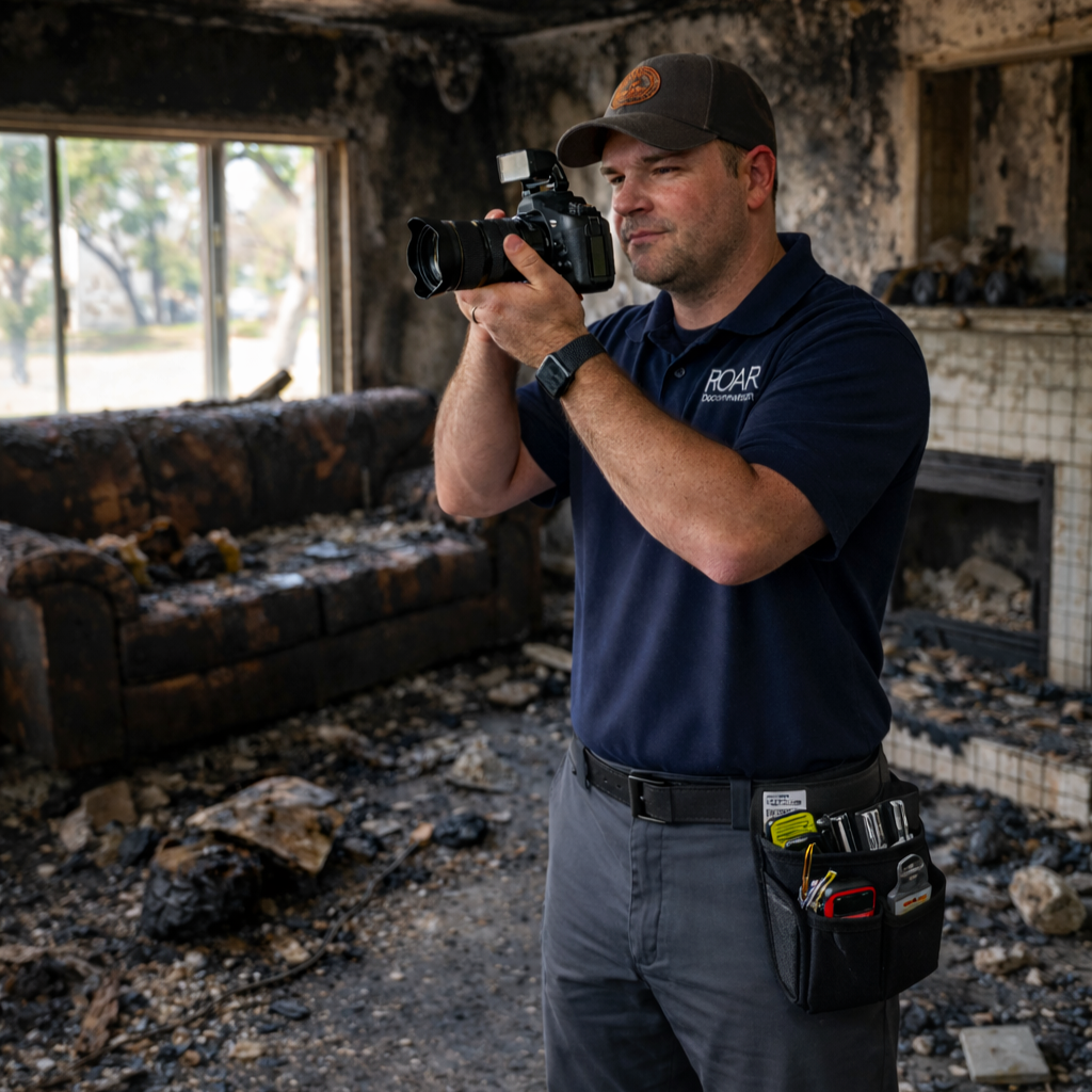 Image 1 of 2
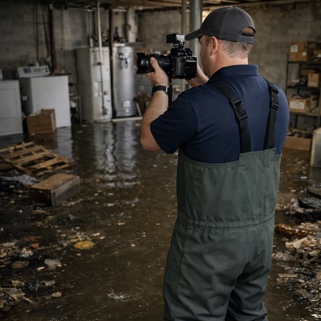 Image 2 of 2