

 Image 1 of 1
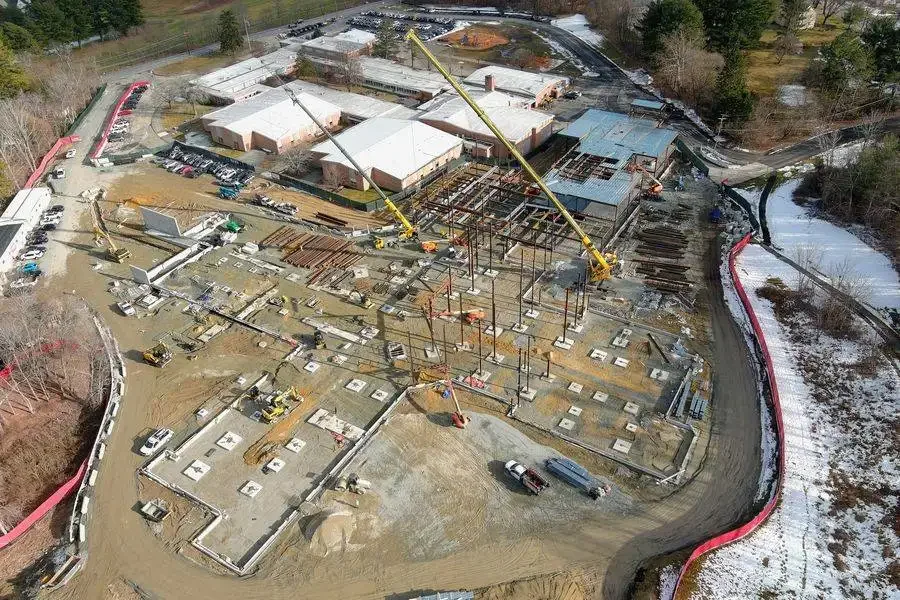
How ROAR Supports Construction Projects
ROAR provides aerial services that integrate easily into active construction workflows, including:
Progress tracking imagery at key project milestones
High-resolution orthomosaic maps showing current site conditions
Documentation of grading, earthwork, and layout changes
Stockpile and material area visualization
Aerial visuals for reports, stakeholders, and records
All deliverables are client-ready and easy to share.
Why Use Aerial Site Documentation?
Aerial imagery provides a clear, overhead view that ground photos can’t match—helping teams verify progress, identify issues early, and communicate site conditions with confidence.
ROAR is Kansas-based and focused on reliable documentation, consistent results, and fast turnaround.
Construction Service Pricing
Pricing is based on common construction use cases and site size.
Construction Progress Flight
$350 – $600 per visit
Construction Mapping & Orthomosaics
$3.00 – $5.00 per acre
(minimum service charge applies)
Ongoing Construction Monitoring
Starting at $750 – $1,500 per month
Notes
Services focus on documentation and visualization only
No engineering, surveying, or design certification provided
Pricing may vary based on site size, complexity, and travel distance